
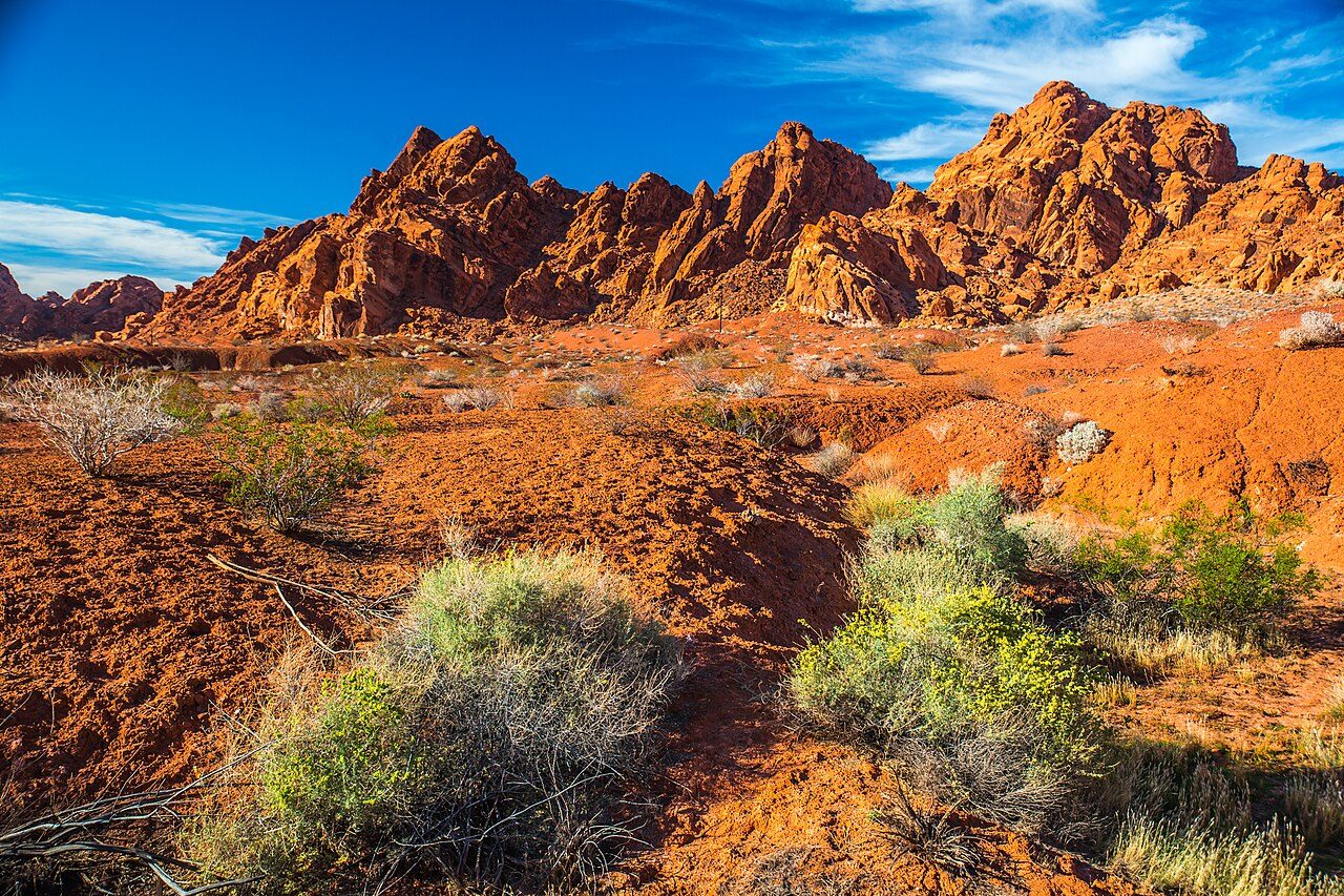

Valley of Fire takes its name from the color of its rock, and at low sun the name stops sounding like an exaggeration. The red outcrops are Aztec Sandstone, the remains of sand dunes that wind piled up during the Jurassic period after inland seas withdrew; erosion has since carved them into domes, arches, fins and hollows. Around them rise gray and tan limestone mountains, which makes the red look even louder.
The park's human history is written on its walls. Nevada State Parks credits people of the Basketmaker culture with carving petroglyphs here about 2,500 years ago, followed later by the Early Pueblo culture farming along the nearby Moapa Valley. Southern Paiute people were living in the area when Mormon settlers arrived at nearby St. Thomas in 1865. The panels show bighorn sheep, human figures, spirals and other designs whose meaning is still debated.
Valley of Fire is Nevada's oldest state park, and its creation stretched over several years. A tract of federal land was handed to the state, the Civilian Conservation Corps built the first facilities and campgrounds in 1933, and the park was formally opened as Nevada's first state park on Easter Sunday 1934. The state legislature gave it legal designation in 1935, the date usually given as its founding. The CCC crews kept working in the park into the early 1940s, building roads, trails and shade shelters that visitors still use. The CCC also built stone cabins as overnight shelter for travelers on the Arrowhead Trail, an early auto road between Salt Lake City and Los Angeles; three of the cabins still stand.
A paved road runs through the park, with spurs to most of the well-known sights. The visitor center, near the middle, has exhibits on geology, ecology, prehistory and history, and the park strongly recommends making it an early stop. From there the scenic road north climbs past Rainbow Vista to the White Domes, while the main highway passes Atlatl Rock, the Beehives and Elephant Rock near the east and west entrances.
The rock is fragile and the petroglyphs are irreplaceable. Stay on trails, never touch or chalk the carvings, and keep off the soft sandstone edges after rain.
Highlights
Atlatl Rock
A sandstone face high above the ground with dense petroglyphs, reached by a metal staircase; the name refers to an atlatl, a spear-thrower, carved on the panel.
Mouse's Tank and Petroglyph Canyon
A short sandy walk through a narrow canyon lined with petroglyphs, ending at a natural basin that holds rainwater.
Elephant Rock
A small eroded arch near the east entrance whose shape gives it its name; a short walk from the road.
Fire Wave and White Domes
Swirled red-and-white sandstone and a loop through pale domes and a slot canyon. Both trails are closed every year from May 15 to September 30.
Heat
Nevada State Parks warns that hiking in high heat is dangerous even on short trails, that trails often feel longer than their listed distance, and that hikers should drink and replace electrolytes. Summer closures of many trails exist because of repeated heat emergencies.
Climate compared with the Strip
Normal daily high and low by month at NOAA's Valley of Fire State Park station (2000 ft), with the Las Vegas high as a dashed line. In July this station averages 105°F, +1°F against the Strip; in January 58°F (+0°F).
Normal high Normal low Las Vegas high Precipitation
| Month | Jan | Feb | Mar | Apr | May | Jun | Jul | Aug | Sep | Oct | Nov | Dec |
|---|---|---|---|---|---|---|---|---|---|---|---|---|
| High °F | 58 | 63 | 71 | 79 | 89 | 100 | 105 | 104 | 96 | 83 | 68 | 57 |
| Low °F | 40 | 44 | 50 | 56 | 65 | 76 | 82 | 80 | 73 | 60 | 48 | 39 |
| Rain in | 0.78 | 1.12 | 0.76 | 0.31 | 0.18 | 0.06 | 0.68 | 0.37 | 0.28 | 0.42 | 0.52 | 0.81 |
| Days ≥100°F | 0 | 0 | 0 | 0 | 3 | 19 | 28 | 26 | 12 | 0 | 0 | 0 |
Sunset here
Sunset and the end of civil twilight at Valley of Fire Visitor Center on the 15th of each month (local time, daylight saving included), and the difference from the Strip. Mountains to the west can hide the sun earlier than the computed time.
| Date | Sunset | Dark | vs Strip |
|---|---|---|---|
| Jan 15, 2027 | 4:46 pm | 5:14 pm | -4 min |
| Feb 15, 2027 | 5:19 pm | 5:45 pm | -3 min |
| Mar 15, 2027 | 6:45 pm | 7:11 pm | -3 min |
| Apr 15, 2027 | 7:12 pm | 7:39 pm | -2 min |
| May 15, 2027 | 7:38 pm | 8:07 pm | -2 min |
| Jun 15, 2027 | 7:58 pm | 8:28 pm | -1 min |
| Jul 15, 2027 | 7:56 pm | 8:26 pm | -2 min |
| Aug 15, 2027 | 7:29 pm | 7:56 pm | -2 min |
| Sep 15, 2027 | 6:46 pm | 7:11 pm | -2 min |
| Oct 15, 2027 | 6:02 pm | 6:28 pm | -3 min |
| Nov 15, 2026 | 4:29 pm | 4:57 pm | -4 min |
| Dec 15, 2026 | 4:24 pm | 4:53 pm | -4 min |
Sources
- parks.nv.gov/parks/valley-of-fire
- parks.nv.gov/learn/park-histories/valley-of-fire-history
- en.wikipedia.org/wiki/Valley_of_Fire_State_Park
- travelnevada.com/?p=20868
- nvtami.com/2021/08/25/valley-of-fire-ccc-cabins/
- reviewjournal.com/?p=1300806
- wikidata.org/wiki/Q920014 (inception 1935)
- OpenStreetMap / Nominatim: Valley of Fire Visitor Center, 29450 Valley of Fire H (coordinates)
Uncertain or disputed
- Founding date: Nevada State Parks says formally opened Easter Sunday 1934, legal designation by the 1935 legislature. Text says both; the brief's 'dedicated 1935' is worded as 'legal designation in 1935, the date usually given'.
- The year of the federal land transfer: Nevada State Parks says 'the 1920s', another source says 1931. Left out.
- Atlatl Rock staircase, Mouse's Tank basin, Elephant Rock near the east entrance, Rainbow Vista and the Beehives: from Wikipedia, Travel Nevada and hiking sources; the official page names Atlatl Rock, Mouse's Tank and White Domes but does not describe them.
- Visitor center coordinates from OpenStreetMap; the Wikidata point for the park (36.4389, -114.5325) is a park centroid, not the visitor center.