
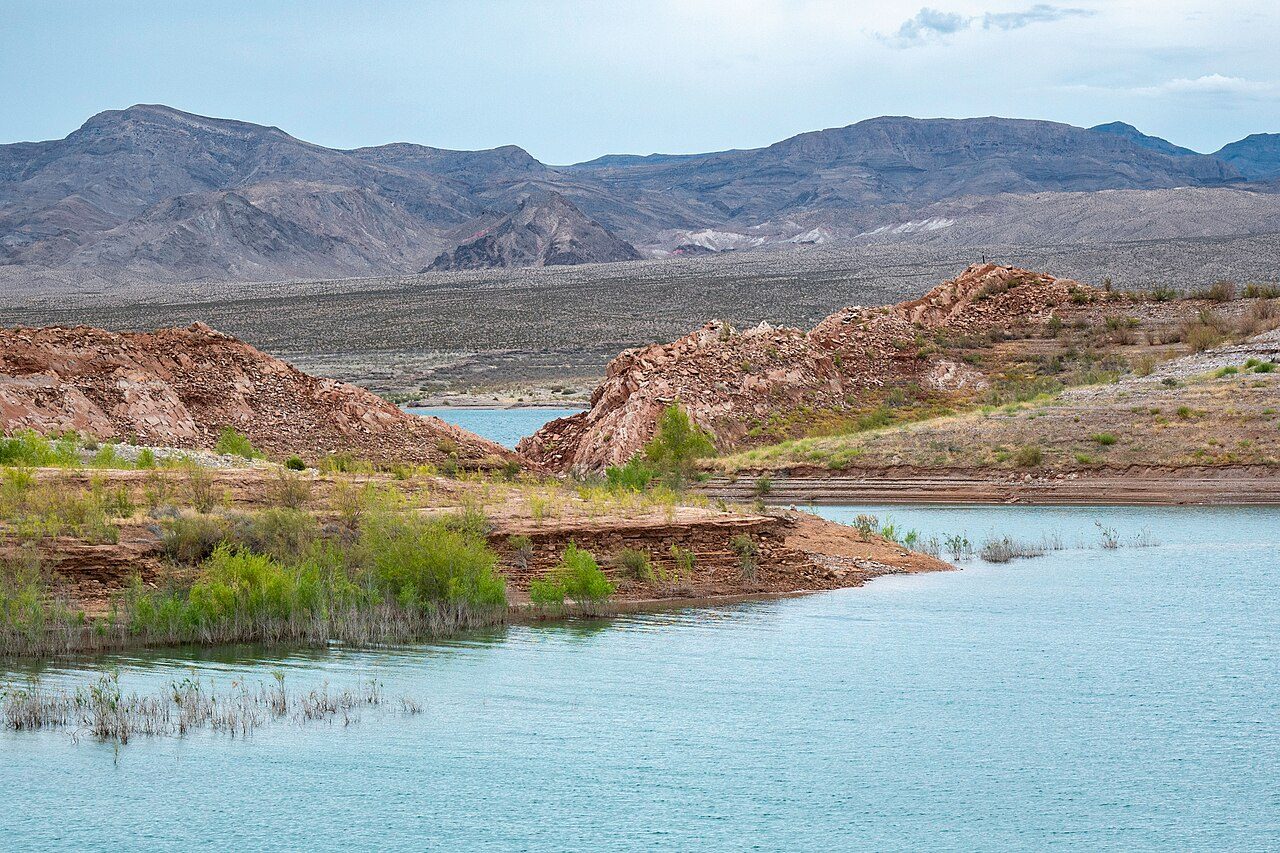

Lake Mead exists because of Hoover Dam. When the dam closed Black Canyon in the 1930s, the Colorado River backed up into the canyons behind it and formed the reservoir, named for Elwood Mead, the Bureau of Reclamation commissioner who oversaw the project. Downstream, Davis Dam later created a second, narrower lake, Lake Mohave. The National Park Service manages the land and water around both, about one and a half million acres of desert, canyon and shoreline across Nevada and Arizona, and in 1964 Congress made it the first national recreation area in the country.
The scenery is a study in contrast: blue water against bare, rust-colored and black volcanic hills, with almost no vegetation between them. In recent years the contrast has gained a third color. During the long drought on the Colorado River the lake has dropped far below its old high-water line, leaving a pale mineral band, often called the bathtub ring, along the cliffs. Marinas and launch ramps have been moved or closed as the water retreated, so conditions on the ground change from year to year.
The drop has also uncovered history. St. Thomas, a farming settlement on the Muddy River founded by Mormon colonists in 1865, was abandoned in the 1930s as the new reservoir rose over it. When the water fell back, its foundations, cisterns and old roadbeds came up again. The NPS now maintains a trail to the site in the northern part of the park, reached by a rough dirt road.
Closer to Las Vegas, the Historic Railroad Trail follows the grade of the line built in 1931 to haul materials from Boulder City to the dam site. Five tunnels, each roughly 25 feet wide, 30 feet high and 300 feet long, were blasted through the hills for the rail cars; the tracks were pulled up in 1962. The trail opened in 1992, and the connection through to Hoover Dam opened to the public in 2007.
The main visitor center sits on Lakeshore Road near Boulder City, a few miles north of Hoover Dam off US 93. It is a sensible first stop for current lake levels, closures and maps, and its garden of desert plants is a gentle introduction to the landscape.
Highlights
Historic Railroad Trail
A wide, nearly level path along the 1930s dam railroad grade through five big tunnels, with views over Lake Mead; it continues to Hoover Dam.
St. Thomas
Foundations and ruins of a settlement drowned by the reservoir and exposed again as the lake fell; reached by a dirt road and a short trail.
Boulder Beach
The most accessible stretch of shoreline near Boulder City, with an entrance station and a swimming area; check the NPS for current water conditions.
Lake Mead Visitor Center
Exhibits, maps and ranger advice on Lakeshore Road, a short drive from Hoover Dam.
Heat
Lake Mead closes several hiking trails during extreme heat warnings, and the NPS and local agencies have recorded heat deaths here. Hike only in the cool hours, carry more water than you think you need, and do not count on a phone signal.
Climate compared with the Strip
Normal daily high and low by month at NOAA's Echo Bay, Lake Mead station (1250 ft), with the Las Vegas high as a dashed line. In July this station averages 107°F, +3°F against the Strip; in January 59°F (+0°F).
Normal high Normal low Las Vegas high Precipitation
| Month | Jan | Feb | Mar | Apr | May | Jun | Jul | Aug | Sep | Oct | Nov | Dec |
|---|---|---|---|---|---|---|---|---|---|---|---|---|
| High °F | 59 | 63 | 72 | 81 | 91 | 101 | 107 | 106 | 97 | 83 | 68 | 57 |
| Low °F | 38 | 42 | 49 | 55 | 65 | 75 | 83 | 82 | 72 | 58 | 46 | 38 |
| Rain in | 0.85 | 0.98 | 0.56 | 0.27 | 0.09 | 0.16 | 0.28 | 0.26 | 0.10 | 0.49 | 0.42 | 0.81 |
| Days ≥100°F | 0 | 0 | 0 | 0 | 6 | 22 | 29 | 29 | 15 | 1 | 0 | 0 |
Sunset here
Sunset and the end of civil twilight at Lake Mead Visitor Center (10 Lakeshore Road, Boulder City; formerly the Alan Bible Visitor Center) on the 15th of each month (local time, daylight saving included), and the difference from the Strip. Mountains to the west can hide the sun earlier than the computed time.
| Date | Sunset | Dark | vs Strip |
|---|---|---|---|
| Jan 15, 2027 | 4:48 pm | 5:16 pm | -2 min |
| Feb 15, 2027 | 5:21 pm | 5:47 pm | -1 min |
| Mar 15, 2027 | 6:47 pm | 7:12 pm | -1 min |
| Apr 15, 2027 | 7:13 pm | 7:39 pm | -1 min |
| May 15, 2027 | 7:38 pm | 8:07 pm | -2 min |
| Jun 15, 2027 | 7:58 pm | 8:28 pm | -1 min |
| Jul 15, 2027 | 7:56 pm | 8:26 pm | -2 min |
| Aug 15, 2027 | 7:29 pm | 7:56 pm | -2 min |
| Sep 15, 2027 | 6:47 pm | 7:12 pm | -1 min |
| Oct 15, 2027 | 6:03 pm | 6:29 pm | -2 min |
| Nov 15, 2026 | 4:31 pm | 4:59 pm | -2 min |
| Dec 15, 2026 | 4:26 pm | 4:55 pm | -2 min |
Sources
- nps.gov/lake/learn/historyculture/index.htm
- nps.gov/lake/learn/historic-railroad-tunnel.htm
- nps.gov/thingstodo/hike-the-st-thomas-trail.htm
- nps.gov/lake/learn/nature/st-thomas-nevada.htm
- nps.gov/lake/planyourvisit/fees.htm
- nps.gov/lake/planyourvisit/visitorcenters.htm
- fox5vegas.com/2026/03/18/hiking-trails-along-lake-mead-closed-during-extreme-hea
- ktnv.com/news/lake-mead-nra-closes-trails-amid-extreme-early-season-heat
- en.wikipedia.org/wiki/Lake_Mead
- wikidata.org/wiki/Q1817736 (visitor center coordinates)
Uncertain or disputed
- Visitor center name: nps.gov visitor-centers page calls it 'Lake Mead Visitor Center' at 10 Lakeshore Road; the fees page still says 'Alan Bible Visitor Center'. Both names given.
- St. Thomas founded 1865 by Mormon colonists: Nevada State Parks Valley of Fire history ('Mormons settled at nearby St. Thomas in 1865') and Wikipedia; NPS gives abandonment in the 1930s.
- Bathtub ring, marinas moved or closed due to low water: widely reported (Wikipedia, local press) but no single NPS page checked; kept general and with no figures.
- Visitor center desert plant garden: Wikidata describes it as 'visitor center and botanical garden'; not confirmed on nps.gov.
- Boulder Beach swimming area: NPS fees page lists a Boulder Beach entrance station; swimming area from general sources.
- Lake Mohave via Davis Dam: Wikipedia; nps.gov history page names Lake Mohave but not Davis Dam.