
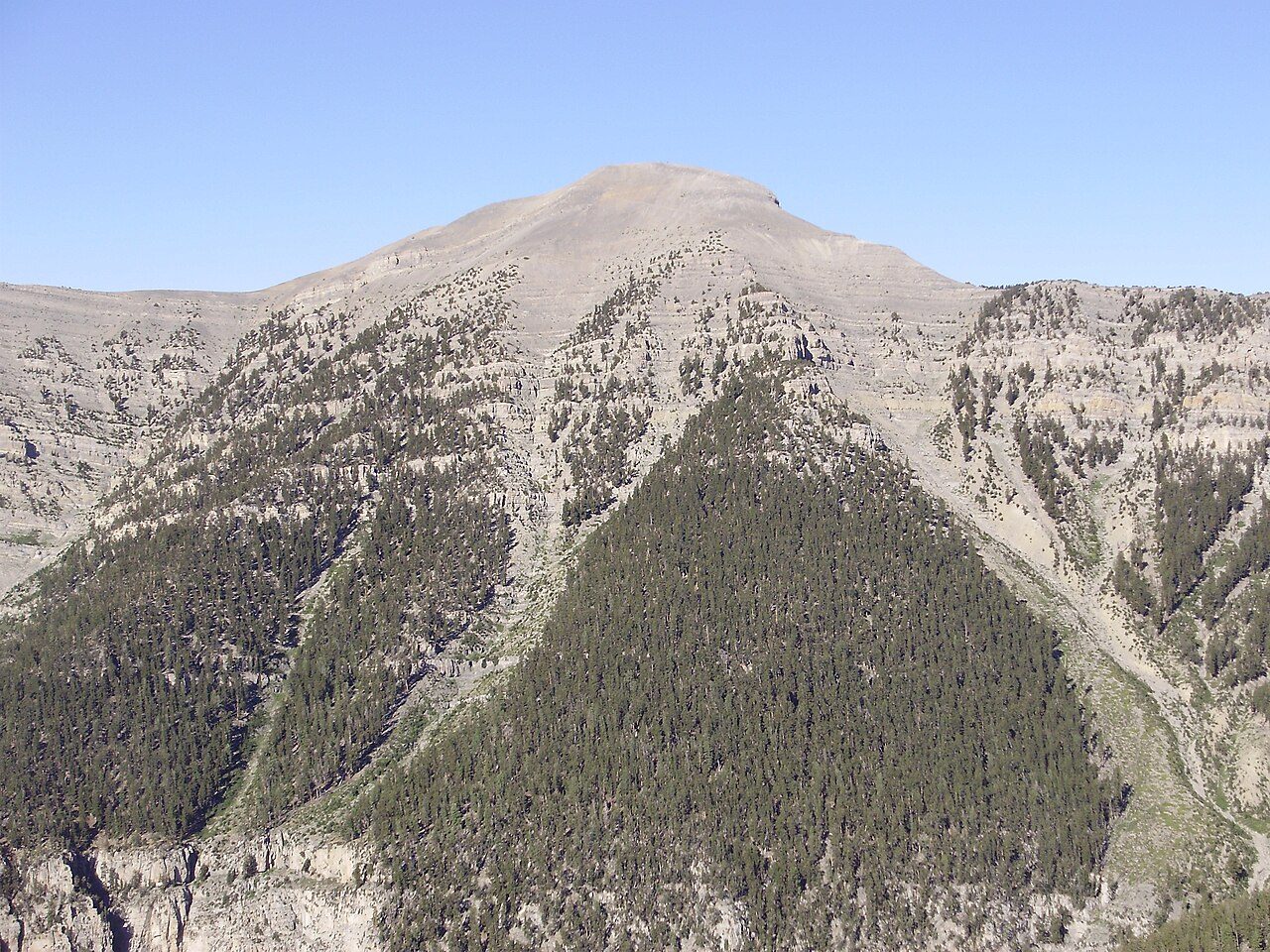

Drive northwest out of Las Vegas and the road keeps climbing until creosote gives way to Joshua trees, then to juniper and piñon, then to tall ponderosa pine and fir. This is the Spring Mountains National Recreation Area, run by the U.S. Forest Service as part of the Humboldt-Toiyabe National Forest. Congress created it in 1993, and it covers about 317,000 acres, ranging from about 3,000 feet in the valleys to 11,918 feet at the top of Charleston Peak, the highest point in Clark County. Most locals simply call the whole area Mount Charleston.
The elevation is the point. Temperatures in the canyons commonly run around 20 °F (11 °C) cooler than in the valley, so the mountain is where Las Vegas goes to escape summer heat and, in winter, to see snow. That same height makes the weather quick to change: summer afternoon thunderstorms, cold nights in spring and fall, and snow and ice on the roads in winter.
Two paved roads climb into the range. Kyle Canyon Road (State Route 157), part of which is designated a Nevada Scenic Byway, leads to the Spring Mountains Visitor Gateway, picnic areas, campgrounds and the small village of Mount Charleston; Cathedral Rock Picnic Area near its upper end is about 30 miles from Las Vegas. Lee Canyon Road (State Route 156) runs to a ski area and campgrounds higher up. Deer Creek Road (State Route 158) links the two along the slope, passing overlooks with long views over the desert.
The range is an island of mountain habitat surrounded by desert, and some of its plants and animals live nowhere else. The Mount Charleston blue butterfly is one of them; the Forest Service closes certain areas to collecting to protect it. Near the summits, ancient bristlecone pines grow on wind-scoured ridges, some of the oldest trees anywhere.
The Visitor Gateway is the place to start. Its complex includes a visitor center, an education building, amphitheaters, picnic sites and links to more than 40 miles of trails, and staff can tell you which trailheads are open, since several have been closed for repairs in recent years. Across the highway, the Cliff Rose Trailhead gives a first taste of the trail network without much more driving.
Highlights
Cathedral Rock
A loop trail from the picnic area of the same name in upper Kyle Canyon climbs toward a prominent rock formation with views down the canyon.
Desert View Overlook
A short paved, wheelchair-accessible path off Deer Creek Road to a viewpoint over the desert; in the 1950s it was a vantage point for watching atomic tests at the Nevada Test Site.
Bristlecone Trail
A trail in upper Lee Canyon among ancient bristlecone pines, reached from the Lower Bristlecone Trailhead; check whether the upper trailhead is open.
Lee Canyon
The higher of the two main canyons, with campgrounds, picnic areas and the area's ski slopes in winter.
Heat
The mountain is the region's heat refuge, but the drive up starts in the desert and lower trails can still be hot; at altitude the sun is stronger and storms build on summer afternoons. Carry water and layers, and turn back if thunder starts.
Climate compared with the Strip
Normal daily high and low by month at NOAA's Mt. Charleston Fire Station station (7460 ft), with the Las Vegas high as a dashed line. In July this station averages 79°F, -26°F against the Strip; in January 44°F (-14°F).
Normal high Normal low Las Vegas high Precipitation
| Month | Jan | Feb | Mar | Apr | May | Jun | Jul | Aug | Sep | Oct | Nov | Dec |
|---|---|---|---|---|---|---|---|---|---|---|---|---|
| High °F | 44 | 44 | 49 | 55 | 63 | 74 | 79 | 78 | 72 | 62 | 51 | 44 |
| Low °F | 22 | 22 | 26 | 30 | 37 | 46 | 52 | 52 | 44 | 35 | 27 | 21 |
| Rain in | 3.70 | 5.12 | 2.91 | 1.01 | 0.82 | 0.31 | 2.21 | 2.34 | 1.71 | 1.79 | 1.32 | 3.16 |
| Days ≥100°F | 0 | 0 | 0 | 0 | 0 | 0 | 0 | 0 | 0 | 0 | 0 | 0 |
Sunset here
Sunset and the end of civil twilight at Spring Mountains Visitor Gateway, Kyle Canyon Road (SR 157) on the 15th of each month (local time, daylight saving included), and the difference from the Strip. Mountains to the west can hide the sun earlier than the computed time.
| Date | Sunset | Dark | vs Strip |
|---|---|---|---|
| Jan 15, 2027 | 4:51 pm | 5:19 pm | +1 min |
| Feb 15, 2027 | 5:23 pm | 5:50 pm | +1 min |
| Mar 15, 2027 | 6:50 pm | 7:15 pm | +2 min |
| Apr 15, 2027 | 7:16 pm | 7:43 pm | +2 min |
| May 15, 2027 | 7:42 pm | 8:11 pm | +2 min |
| Jun 15, 2027 | 8:02 pm | 8:32 pm | +3 min |
| Jul 15, 2027 | 8:00 pm | 8:29 pm | +2 min |
| Aug 15, 2027 | 7:33 pm | 8:00 pm | +2 min |
| Sep 15, 2027 | 6:50 pm | 7:16 pm | +2 min |
| Oct 15, 2027 | 6:06 pm | 6:32 pm | +1 min |
| Nov 15, 2026 | 4:34 pm | 5:01 pm | +1 min |
| Dec 15, 2026 | 4:29 pm | 4:57 pm | +1 min |
Sources
- fs.usda.gov/r04/humboldt-toiyabe/recreation/spring-mountains-national-recreation
- fs.usda.gov/r04/humboldt-toiyabe/recreation/desert-view-outlook
- gomtcharleston.com/wp-content/uploads/smnra-summer-guide.pdf (Forest Service summer guide)
- bouldercityreview.com/sports/recreation/new-gateway-introduces-visitors-to-sprin
- en.wikipedia.org/wiki/Mount_Charleston,_Nevada
- reviewjournal.com/?p=1668402
- en.wikipedia.org/wiki/Nevada_State_Route_157
- wikipedia.com/wiki/Deer_Creek_Road
- wikidata.org/wiki/Q14705277
- OpenStreetMap way 571835222 (visitor center building, Kyle Canyon Road)
Uncertain or disputed
- Gateway coordinates (36.2711, -115.5877) are from an OpenStreetMap building tagged 'Mount Charleston Visitor's Center' with a fixme on the name; not confirmed from an official source.
- Acreage: Forest Service page says 317,000 acres; the Forest Service summer guide says about 316,000. Text uses 'about 317,000'.
- 'About 20 °F cooler': Wikipedia (mean high 20.4 °F cooler) and Las Vegas Review-Journal (20–25 °F); not a Forest Service figure. Worded as 'commonly around'.
- Charleston Peak as highest point in Clark County: Wikipedia; Forest Service gives the elevation only.
- Mount Charleston blue butterfly found nowhere else: USFWS/Wikipedia; the Forest Service page only lists a 'Butterfly Collection Closure Area'.
- Lee Canyon Road = SR 156, ski area in Lee Canyon: Wikipedia and local sources; not on the Forest Service page checked.
- Desert View Overlook atomic-test history: secondary sources (Wikipedia/birdandhike/local history), not the Forest Service page; reportedly.
- Trailhead closures (Mary Jane Falls, Trail Canyon, Upper Bristlecone) were current on the Forest Service page on 2026-10-29 and may change; the practical point says 'as of late 2026'.